MOBILE LIDAR: MAPPING & GIS
LIDAR On The Move:
Unlike 'Stationed Terrestrial LiDAR', where the LiDAR is 'positioned' or 'static', 'Mobile LIDAR' collects high accuracy surface models while actively moving on a vehicle or other movable ground based platform, allowing for efficient collection of data over extended routes. Interesting fact, while airborne platforms are also 'mobile' - the term 'Mobile LIDAR' is typically associated with platforms moving on the ground. Access Geographic offers diverse Mapping and GIS (Geographic Information Systems) that collect, process and make Mobile LIDAR data an effective geospatial resource.
LIDAR Surface Modeling & Mapping:
LiDAR stands for 'LIght, Detection And Ranging'. This process basically involves the firing of laser pulses, measuring the distance between the LiDAR Unit and visible surface areas. These individual measurement points are combined to form a 'surface model', offering diverse mapping applications ranging from engineering grade technical measurements to 3D Virtual Reality Environments. For a broader overview on LIDAR acquisition methods, please visit LiDAR Services.
Mobile LIDAR Advantages & Limitations:
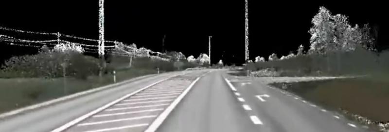
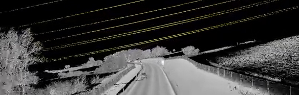
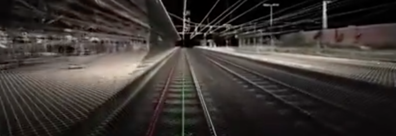
Mobile LiDAR is very effective for collecting large amounts of spatial information along linear routes. This often associated with transportation corridors such as roadways and railways and utility corridors where the subject matter of interest is more or less within a contained within the adjacent field of view. There is efficiency here because the acquisition unit is able to focus on the surrounding feature surfaces associated with the route (whether it be roadways, railroad tracks, building edifices, vegetation, power lines, and other adjacent infrastructure) that is in direct conjunction with the corridor as the Mobile LiDAR unit moves along its route. In contrast, while Aerial LiDAR can be more 'comprehensive' in its data collection of an area, it may not capture feature surface perspectives as effectively as a Mobile LIDAR unit running through a focus area. Nevertheless, a Mobile LIDAR dataset can also be supplemented with stationed Terrestrial LIDAR and Aerial LiDAR collection methods as needed.
Mobile LIDAR Backpacking:
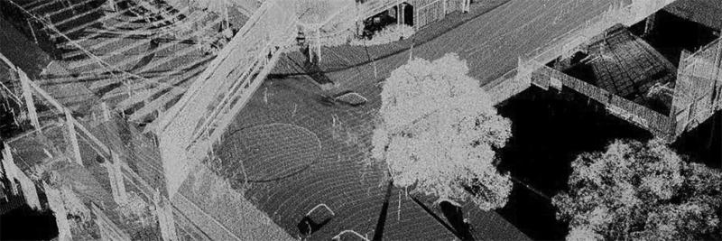
An interesting middle ground between 'Stationary' or 'Static' Terrestrial LiDAR and Mobile LiDAR is when a person becomes mobile the 'platform' for a LiDAR Unit by using a LIDAR Backpack. Obviously, a person can be more nimble and exploratory than most surface vehicles, allowing for more localized and technical routing and data collection. This can include interior building spaces, mine shafts, subterranean utility systems, nature trails, rooftops and even mountain climbing, wherever a person can fit - Mobile LiDAR can go.
Mobile LIDAR Automation & Robotics:
Seems like we can't talk about cars (or even people...) these days without discussing Automation and Robotic capabilities. Robotic Mobile LIDAR platforms can be deployed for scheduled, progressive acquisitions or active remote control within indoor and outdoor spaces. In addition, these platforms can offer effective mapping options for environments that present human hazards. Interestingly, Mobile LiDAR is playing a critical role in autonomous navigation systems including 'self-driving cars', actively mapping surroundings for automated spatial intelligence and situational response.
We Are Here To Help:
We are excited about the capabilities for this innovative technology and look forward to talking about effectively integrating Mobile LiDAR Solutions into your next GIS and Mapping project. Access Geographic can deploy anywhere across North America with the latest in Mobile LiDAR technology and services. Please feel to contact us!