![]()
ph: (480) 709-2710
info
LIDAR: Mapping & GIS
LIDAR: AERIAL, TERRESTRIAL, MOBILE & UAS
Getting to Know the Lay of the Land...
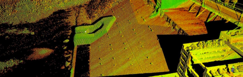
Another utility in the geospatial arsenal is LiDAR or 'Light Detection and Ranging'. In recent years, its accessibility and improved management software has shaped LiDAR, including Mobile LIDAR (Learn More), into a mainstream acquisition tool for detailed surface modeling, with the scalability to map an entire mountain range or the surface of a single electrical outlet. With this in mind, LiDAR has a broad range of geospatial applications ...inside and out.
So, What Is LIDAR?
As the acronym suggests, LiDAR is basically this: '(Li)ght': Is simply a narrow beam of light similar to a standard laser. '(D)etection': This pulse of light is fired at a surface, bounces back and is received (or detected) again by the acquisition system. '(A)nd': Well, it's a conjunction. '(R)anging': The time it takes for the light to fire and return indicates the distance (or range) between the system and the surface, referencing a point of elevation. The light pulse is fired continuously, elevation points are rapidly acquired over an extended area, and (gathered together), these points form the basis of a contiguous surface model.
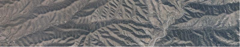
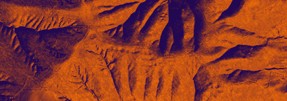
From the Air:
Just like camera systems, LiDAR units can be placed on aircraft including UAS (Learn More) and used to acquire surface data at various resolution intensities. Often LiDAR 'resolution' is defined in points per a square Meter.
Initially, the raw data acquired by LiDAR picks up anything it hits, such as buildings, trees, cars and other objects, creating a 'point cloud' representation or Digital Surface Model (DSM) - adaptable for corridor encroachment monitoring, viewshed assessment, wireless network modeling and surface cover analysis.
This LiDAR surface data can be taken a step further to generate a terrain model, stripping the raw information down to the earth's terra-firma. The data goes through a 'cleaning' phase, removing the buildings, trees, cars, etc..., so that the model represents a 'bare earth' or Digital Terrain Model (DTM) often used in drainage analysis, contour mapping or even Digital Elevation Models (DEM) for orthophotography processing.
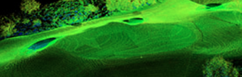
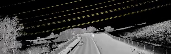
From the Ground:
Ground based (or 'Terrestrial') LiDAR takes many forms from stationary ground units to Mobile LiDAR (Learn More) units mounted on vehicles depending on the extent and level of detail a surface model requires. This can include ultra high resolution details of a building facade, cliff side erosion, street potholes and even accident scenes that require nuanced spatial documentation. It can also be applied to more comprehensive applications such as capturing extensive sections of streetscapes, roadway surfaces and pipeline corridors depending on the project goals.
From the Inside:
Sometimes it is easy to overlook that geography continues inside structure as well as outside. Interior LiDAR surface models have a wide variety of mapping applications, including structural assessments, emergency management modeling, construction planning or even documenting areas that have limited human accessibility such as ceiling spaces.
LiDAR can also serve as a powerful baseline for developing Building Information Management (BIM) models, which can be easily integrated into mainstream CAD systems such as REVIT and AutoDesk.
Putting LIDAR to Work
Overall, LiDAR has quite a broad range of approaches and applications for mapping and geospatial information projects. Whether your looking aerial or ground based acquisitions, Access Geographic has field teams across North America ready to respond with the latest LiDAR technology. Feel free to Contact Us Today, we'd be happy to field any questions you have about putting LiDAR to work for your project and please visit our UAS LiDAR and Mobile LIDAR sections for more information.
SURFACE MODELING:
- Landscape Visualization
- Environmental Monitoring
- Foreign Contact Audits
TERRAIN MODELING:
- Flood Plain Analysis
- Volume Calculations
- Contour Mapping
MOBILE MAPPING:
- Streetscape Visualization
- Utility Mapping
- Asset Management
3D STRUCTURAL MODELING:
- Construction Monitoring
- Infrastructure Assessment
- Condition Documentation
INTERIOR MAPPING & BIM:

- Building Information Systems
- Facilities Management
- Emergency Simulation
Copyright 2023 Access Geographic, LLC. All rights reserved.
ph: (480) 709-2710
info